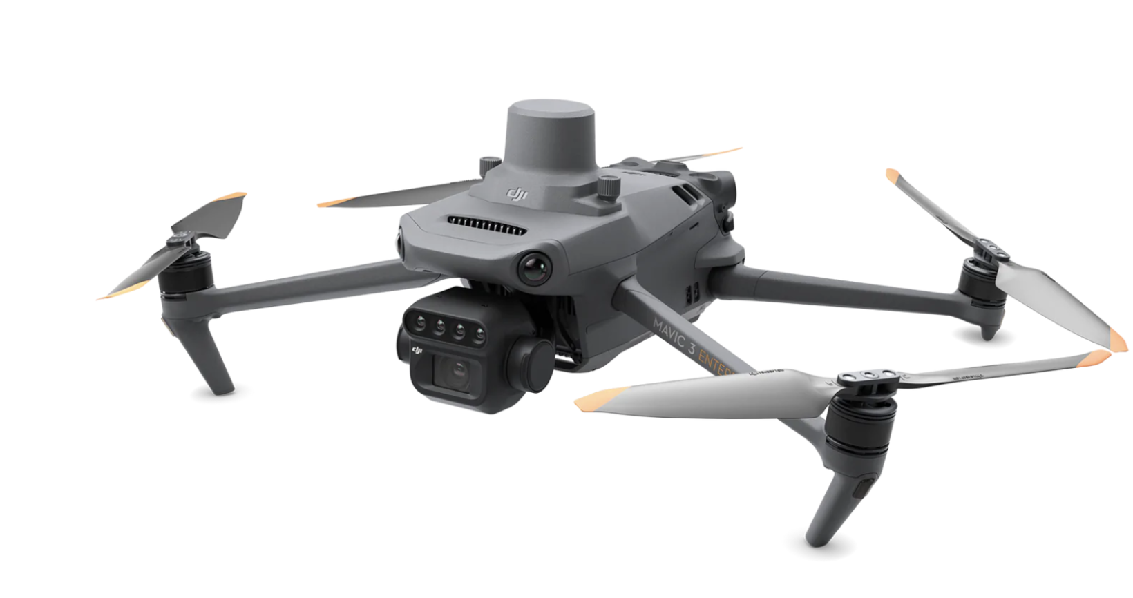
DJI Mavic 3 Multispectral
High-performance aerial surveyor
£3700.00
Out of stock
Experience the future of aerial photography with our state-of-the-art quadcopter drone! Featuring a high-resolution camera for stunning visuals, an extended flight time for longer missions, and a durable build that can withstand tough flying conditions, this drone is ideal for both professional and hobbyist use. It comes in sleek black and white colors, with a compact yet powerful design that's easy to transport. Elevate your perspective and capture the world like never before.
Realtime NDVI
4x 5MP spectral bands
20MP RGB camera
Realtime terrain-follow
RTK with centimetre-level accuracy
DJI SmartFarms software
DJI Mavic 3 Multispectral
Effective aerial surveying needs to see the invisible. That's why Mavic 3 Multispectral has two forms of sight. It combines an RGB camera with a multispectral camera to scan and analyze crop growth with total clarity. Agricultural production management requires precision and data, and Mavic 3M delivers both
Multispectral Camera
4 × 5MP
G/R/RE/NIR
RGB camera
20 MP
4/3 CMOS, mechanical shutter
Safe and stable
Omnidirectional Obstacle Avoidance
15km Transmission Distance
Precise positioning
Centimeter-level RTK positioning
Microsecond-level time synchronization
Efficient aerial surveying
Up to 200 hectares per flight
Multispectral + RGB imaging system
Newly upgraded imaging system with one 20MP RGB camera and four 5MP multispectral cameras (green, red, red edge, and near-infrared). Enables applications such as high-precision aerial surveying, crop growth monitoring, and natural resource surveys.
Sunlight Sensor
The built-in sunlight sensor captures solar irradiance and records it in an image file, allowing for light compensation of image data during 2D reconstruction. This results in more accurate NDVI results, as well as improved accuracy and consistency of data acquired over time.
RTK module
Accurate images that capture every pixel
Mavic 3M with RTK module for centimeter-level positioning. Flight control, the camera, and the RTK module sync in microseconds to accurately capture the location of each camera's imaging center. This enables Mavic 3M to do high-precision aerial surveying without using ground control points.
Efficient and reliable battery life
43 minutes Cruise time
200 hectare
A single flight can complete mapping operations over an area of 200 hectares.
Fast charging
100W Battery Charging Hub - High-efficiency fast charging
IN THE BOX
1 x DJI Mavic 3 Multispectral Drone
1 x DJI Mavic 3 Intelligent Flight Battery
1x DJI Mavic 3 RTK Module
1 x MicroSD Card
1 x DJI RC Pro Enterprise
1 x Power Cable
1 x USB-C Cable
3 x Propeller (pair)
1 x Charger
1 x USB-C to USB-C Cable
1 x Carrying case
1 x Screwdriver